The complete guide. Every button, every tool, every trick — in the order you would naturally use them. Nothing left out, including the things the map does not do.
1
Getting started
01
Opening the map

The whole of DHA Lahore on one screen — every phase, every block, every plot. There is no login, no menu and no settings page. Everything is on this one screen.
- Open the Plot Finder from the top menu of the website, or from the Plot Finder button on the home page.
- The map opens showing all of DHA Lahore at once.
- You immediately see coloured blocks (each residential block its own colour, commercial dark red, parks and golf dark green, villages dark yellow, grey ground which is the roads), and phase names written across the map in light blue.
- Top-left is the white search panel. Top-right is the Map / Satellite panel. Bottom-left is the colour legend.
- Under the search box there is always a help line telling you what you can type.
Try this on the Plot Finder→02
Zooming and moving around

How much detail you see is decided only by how far you have zoomed in. There is no "detail" setting — the map reveals more as you get closer.
- The + and − buttons sit on the right, just under the Map / Satellite box. This is the simplest way.
- On a computer: scroll wheel to zoom, click and drag to move, double-click to zoom in.
- On a phone: pinch with two fingers to zoom, one finger to drag, double-tap to zoom in.
- Keyboard: click once on the map, then arrow keys move it and + / - zoom. Esc closes an open box.
- As you zoom in, more appears — the table below shows exactly what appears when.
| Zoom | What appears |
|---|
| Always | Phase boundaries and phase names |
| 14 and closer | Block letters and the green phase chip |
| 15 and closer | Plot shapes load, block colour fill switches off, and the For Sale / For Rent pins appear |
| 16 and closer | Place icons with name and size — masjid, school, hospital, water tank, petrol pump, police, golf, graveyard |
| 17 and closer | Plot numbers written on the plots |
The map loads at most 6,000 plots for one screen and writes at most 900 plot numbers. If an area looks empty, zoom in a little more.
Try this on the Plot Finder→03
Map or Satellite

Switch between the plain street map and real aerial photography of the ground.
- Top-right, click "Satellite".
- The background becomes real aerial imagery, and our colour layer automatically drops to 0% so you see the ground as it really is.
- Road names stay visible and turn white so they can be read over the photo.
- A plot that is For Sale or For Rent keeps its green or blue tint on satellite, and its pin stays on it.
- Click "Map" to go back — the colours come back on their own.
Try this on the Plot Finder→04
The layer slider (fading our colours)

Our colour layer sits on top of the base map. This slider fades it so you can see what is underneath, without losing anything you can click.
- Top-right, under the Map / Satellite buttons, is a slider labelled "PlotPedia layer — 100%" (on MiroEstate: "MiroEstate layer — 100%").
- Drag it left to fade the colours, right to bring them back. The number updates as you drag.
- Block colours, plot colours and outlines all fade together.
- Even at 0% the plot numbers, place names and clicking still work — you can still click a plot and open its details.
Try this on the Plot Finder→2
Finding a plot
05
The search box — one box for everything

There is only one search box and it understands phases, blocks, plot numbers, place names and the nicknames the market actually uses.
- Click the box at the top-left. It reads "Search phase / block / plot / place...".
- Start typing. After a moment a list drops down under the box.
- Each row starts with a small green tag telling you what it is: PLOT, PLACE, PHASE, BLOCK or ILAQA (a named area).
- Click a row. A plot or place jumps the map to it, lights the plot up with a red outline and gold fill, drops a red pin and opens the travel card. A block or phase zooms to that area with a dashed red box around it. An ilaqa draws its real outline in red.
| You can type | Example |
|---|
| Just a plot number | 3857 |
| Block and plot, any order, space or no space | f1070 · 1070 f · kk 85 |
| Phase, block and plot | phase 7 y 3857 · p7 y 3857 |
| A phase | 7 · phase 7 · p9 · 12c |
| A phase and block | 7 y · phase 7 block y · y block phase 7 |
| Market nicknames | eme · prism · park view · broadway · ivy green · rahbar · villas · halloki |
| Part of a place name | masjid · park view |
Phase 9: writing 9 or prism means Phase 9 Prism. For Phase 9 Town you must write "9 town". If nothing matches, the list shows a single row saying "No results".
Try this on the Plot Finder→06
Press Enter to jump straight to a plot

When you already know the plot, you do not need to look at the list at all.
- Type the plot, for example 7 y 3857.
- Press Enter.
- The map goes straight to the first matching plot, lights it up, drops the pin and opens the travel card.
- If no plot matched but a phase or block did, the map goes to that instead.
Try this on the Plot Finder→07
Clicking a phase or a block on the map

You do not have to search at all — you can simply click your way in.
- Zoom out until the coloured blocks are visible.
- Click a coloured block — the map zooms so that block fills the screen.
- Click inside a phase but not on a block (on the grey ground) — the map zooms so the whole phase fills the screen.
Commercial zones (CCA1, Broadway and so on) work the same way. They are shaded in light red and carry their name chip, and clicking one zooms to it just like a block.
Try this on the Plot Finder→08
The phase chip — always knowing where you are

When you are zoomed right in, the big phase name has scrolled off the screen. This chip keeps telling you which phase you are in.
- Zoom in to 14 or closer.
- A dark green chip appears at the top of the screen with the phase name of whatever is in the middle of your screen — for example "Phase VII".
- Move the map and the chip name changes by itself.
- Zoom back out and it disappears. It is only for reading; it cannot be clicked.
Try this on the Plot Finder→09
Plot numbers and the icons for places

The map writes the numbers and marks the notable places by itself. There is no switch for these — they follow the zoom.
- Zoom to 16 — every notable place gets an icon, its name and its size stacked in three lines, for example the mosque icon, then "Masjid", then "4 Kanal".
- Zoom to 17 — plot numbers appear written on the plots. Commercial numbers are written first because those plots are small.
- On satellite the numbers turn white with a dark shadow so they stay readable.
Try this on the Plot Finder→4
For sale and for rent
12
The For Sale and For Rent pins

Live listings from dealer groups, from Zameen and from our own agents, each shown as a small pin standing on the plot it belongs to. Nothing is written on the pin — the colour alone tells you what it is.
- Zoom to 15 or closer.
- Teardrop pins appear, each with a white building drawn inside it. Every pin on the map is the same size — nothing is drawn bigger because it costs more.
- Green pin = For Sale. Blue pin = For Rent. That is the whole code.
- The pin carries no words and no price, so the plot number underneath stays readable. The price comes when you click.
- Click a pin and it turns red and its box opens (next section). Whatever you clicked is always the red one.
- The plot under the pin is tinted in the same colour, so you can see the real shape and size of what is on the market.
At most 250 pins are drawn on one screen. If there are more, a small line appears under the search box: "Showing 250 of 519 here — zoom in for the rest." Nothing is hidden from you without being told.
Try this on the Plot Finder→13
Zoomed out — the count pins

Below zoom 15 there is no room for a pin on every plot. Instead each area shows one pin with the number of live listings in it, so you can see at a glance where the market is busy. It is the same teardrop pin at the same size — only a number inside it instead of the building.
- Zoom out until the building pins turn into number pins.
- Coloured pins appear across DHA, each with a number inside — that is how many live listings are in that patch.
- The colour follows the same rule as the pins: green means all of them are For Sale, blue means all For Rent, purple means a mix of both.
- Hover over a pin and it tells you the split, for example "146 listings · 141 For Sale · 5 For Rent".
- Click a pin and the map zooms into that area. Keep clicking and you end up at the individual pins.
These pins obey the filters. Choose "For Rent" and every one of them turns blue and the numbers drop to the rent-only count.
Try this on the Plot Finder→14
The listed plot is tinted — nothing blinks any more
So you can see the real shape and size of the plot that is on the market, not just a marker floating above it.
- Zoom to 15 or closer over an area that has listings.
- Every listed plot carries a steady tint — green if it is for sale, blue if it is for rent — with a white outline.
- The tint does not move and does not flash. It sits quietly under the pin.
- On satellite the same plot is drawn as a coloured shape with a white outline while everything around it stays a plain photograph.
Until 15 September 2026 these plots blinked about twice a second and each one carried a large red bubble with the price written on it. Both are gone: at close zoom the bubbles covered the map and hid the plot numbers, and none of the five biggest property sites in the world does it that way.
Try this on the Plot Finder→15
Houses and flats — the number pins on the block
A house, a flat or an office does not have a plot number the way an empty plot does, so it cannot be put on one exact plot. These are collected on the block they belong to and shown as one dark pin with a number on it.
- Zoom to 15 or closer.
- Besides the green and blue pins you will see dark grey pins with a number written on them — that number is how many houses and flats are on the market in that block.
- Click one. It turns red and a box opens saying, for example, "Phase 7, Block Y · 34 for sale · 6 for rent", and under it the list of those properties with their price and date.
- Each line in that list opens the property.
This is an honest limitation, not a shortcut. Zameen does not publish the exact location of a house — it publishes the area. In the data we hold, 12,582 houses sit on only 350 points, and 1,765 of them sit on one single point. Dropping them on a made-up plot would be a lie, so we place them on the block, which is true.
Try this on the Plot Finder→16
A plot with no pin — click it anyway

Most plots in DHA are not on the market today. They carry no pin, but they are not dead ends: click one and the map tells you what it knows about its market history.
- Click any plot that has no pin on it.
- Its usual box opens with the plot number, block, phase and the DHA-record size.
- Under that, the map looks up the market record and writes one of three things.
- If it was on the market before: the last asking price, what it was listed as, the date and time, and how many times it has come to the market.
- If it has come up more than once, it says so — for example "Came to the market 3 times".
- If it has never been recorded: "Never recorded on the market." That is an honest answer, not an error.
- The link to the plot page is there as always.
This is what the old map could not do at all. Before 15 September 2026, a plot with no listing simply had nothing to say.
Try this on the Plot Finder→17
The listing box — what is on offer and who to call

Everything known about that one listing, including the agent, the agency, the phone number and the original message itself.
- Click a green or blue pin. It turns red and the box opens.
- The coloured strip at the top reads "For Sale · Plot" or "For Rent · Shop", under it the price, and under that "Phase 7, Block Y, Plot 3857 · 1 Kanal". The size comes from the DHA record, not from the agent.
- Then Agent, Agency and Phone. The phone number is a live link — on a phone it dials.
- Where we do not know the name or the agency, that line is simply not there. Nothing is invented.
- If nothing at all is known it says "No contact recorded for this one."
- Then "Updated: 27 Aug 2026, 1:54 pm" — the date and the time. Every property on our sites carries this.
- Then two buttons: "Full WhatsApp message" (or "Full advert" for a Zameen listing) opens the original text right inside the box, and "Full detail" opens the page of that plot in a new tab.
Open a second box and the first one closes by itself. Only one is ever open, so the map never fills up with boxes.
Try this on the Plot Finder→18
Filters — showing only the listings you want

DHA has thousands of live listings at once. The Filters box narrows the map down to the ones you actually care about. Nothing is sent anywhere — the map already has the information, so the moment you press a button the map changes.
- In the left panel, under the Draw Area and Commute buttons, click "☰ Filters". The box opens; the grey text beside it always shows the count, for example "4,554 listings".
- For sale or for rent: press All, For Sale or For Rent.
- Property type: press All, Plot, House or Commercial.
- Demand (lakh): type a minimum, a maximum, or both. 100 lakh is 1 crore.
- Plot size — DHA record: pick a size from the list (5 Marla, 10 Marla, 1 Kanal and so on). The list is built from the sizes actually on the map, so it never offers you a size that has nothing in it.
- Everything changes together as you choose: the pins, the tinted plots and the count pins.
- The count now reads, for example, "39 of 4,554", and the Filters box turns green so you always know a filter is on.
- Press "✕ Clear all filters" to go back to everything.
Two honest points. The demand filter only keeps listings that actually have a price written on them — a listing with no price cannot be inside a price range. And the size comes from the DHA record, not from the agent, so if a plot has no size in the DHA record it will not appear under any size.
Try this on the Plot Finder→19
Show or hide places — masjid, school, hospital…

The map marks notable places by itself. If they get in the way of what you are looking at, you can switch any of them off.
- Open the Filters box and look at "Show these places".
- There are eight pills: 🕌 Masjid, 🏫 School, 🏥 Hospital, 💧 Water tank, ⛽ Petrol pump, 🚓 Police, ⛳ Golf, 🪦 Graveyard.
- A green pill means that kind of place is being shown. Click it and it turns grey — those icons disappear from the map at once.
- Click it again to bring them back.
- "✕ Clear all filters" switches all of them back on as well.
These icons only appear from zoom 16 onwards anyway. If you switch one on and see nothing, you are probably not zoomed in far enough.
Try this on the Plot Finder→20
The colour key

Every colour on the map is explained in one box.
- On a computer the key sits at the bottom-left and is always visible.
- It lists: Residential (each block its own colour), Commercial (dark red), Park / Golf (dark green), Village / Abadi / Unplanned (dark yellow), Roads (grey), the icons for notable places, and the pins: green for sale, blue for rent, red for the one you clicked, and a dark number pin for the houses in a block.
- On a phone the key is hidden so it does not cover the map. Tap the white "🎨 Legend" button at the bottom-left to show it, and tap again to hide it.
Try this on the Plot Finder→5
The two big tools
21
Draw Area — draw your own search area

A block boundary is not always what you want. Draw any shape on the map and it tells you how many plots are inside it and which of them are on the market right now.
- Top-left, click "✏️ Draw Area". The button turns dark green and the pointer becomes a crosshair.
- Under the box you now see: "Draw Area: click points on the map (at least 3), then press Finish." with a live counter "Points: 0".
- Click points on the map, one by one, around the area you want. After each click a dashed green shape is drawn and the counter goes up.
- When you have at least 3 points, click "✓ Finish".
- The map zooms to fit your shape, draws it in solid green, and shows a result line such as "1,240 plots in this area — 7 For Sale · 2 For Rent (live listings)".
- Under it is the list of live listings, each row like "SALE Ph 7 Y-3857 (1 Kanal) — 4.5 crore". Click any row and the map jumps to that plot.
- Click "✕ Clear" to remove the shape and the results.
There is no undo for a single point — you either Finish or Cancel and start again. If there are no listings inside your shape it says so plainly, and the plot count is still shown.
Try this on the Plot Finder→22
Commute Time — how far from work can I live

Mark the place you travel to every day, say how many minutes you are willing to travel, and it shows you that circle and the listings inside it.
- Top-left, click "⏱ Commute Time". The pointer becomes a crosshair.
- Click the place you travel to daily — your office, your children’s school, the market.
- A blue marker drops there and it asks: "Destination set. How many minutes away should properties be?"
- Choose one of five buttons: 5 min, 10 min, 15 min, 20 min or 30 min.
- The map draws a blue circle around your destination and shows the same kind of result line as Draw Area, with the listings inside listed underneath.
- Click a row to jump to that plot, or "✕ Clear" to remove the circle.
Be clear about this: it is a straight-line estimate at about 25 km/h city speed, not real road timing. 10 minutes is about 4.2 km, 30 minutes about 12.5 km. Traffic and one-way roads are not counted. The panel says this too.
Try this on the Plot Finder→6
Getting to the plot
23
The travel card

Whenever you pick a plot — from search, from Enter, from a Draw Area result, from a link — this card opens at the bottom-right with everything you need to actually get there.
- Pick a plot in any way. The card appears bottom-right.
- It shows the title, for example "Plot 7/Y/3857", and three buttons: "Show route", "▶ Start" (hidden until a route exists) and "Google Maps".
- On a phone the card stretches across the bottom of the screen.
- Click the × to close it — this also removes the route line and your location dot from the map.
Try this on the Plot Finder→24
"Show route" — how far and how long from where you are
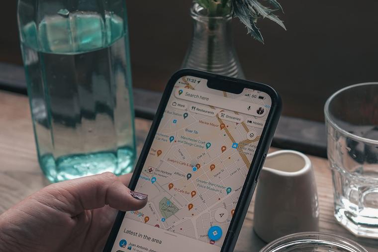
Real road routing from your location to that plot, drawn on the map.
- Click "Show route".
- The card says it is finding your location. Your browser asks permission — allow it.
- A blue dot marks you on the map and a blue route line is drawn from you to the plot along real roads.
- The map zooms out to fit both you and the plot.
- The card shows, for example, "12.4 km · about 26 min by car", and the "▶ Start" button appears.
If you blocked location for the site, it tells you exactly how to allow it again. If the routing service cannot be reached, you get a dotted straight line and the words "straight-line distance" instead — and in that case the Start button does not appear.
Try this on the Plot Finder→25
"▶ Start" — spoken navigation inside our own map

Full turn-by-turn driving guidance without leaving the map and without Google.
- Click "▶ Start" (it only appears after a real route was found).
- A dark blue banner takes over the top of the screen and the panels move out of the way.
- The banner shows a big arrow, the instruction — for example "In 300 m, turn right onto Sector Y Road" — and a red "End" button.
- Under it: how much is left, for example "6.2 km left · about 13 min".
- Each instruction is also spoken out loud once, when you come within about 220 metres of the turn.
- The map follows you and keeps you in the centre.
- If you leave the route it says "Recalculating route…", says it out loud, and works out a new one.
- On arrival it shows a chequered flag, says "You have arrived at your destination" and closes itself after a few seconds.
- To stop early, tap the red "End".
Try this on the Plot Finder→26
"Google Maps" — hand it over to Google

If you would rather drive with Google’s voice, one button hands the exact point over.
- Click "Google Maps" in the travel card.
- Google Maps opens in a new tab, or in the Google Maps app on a phone, already set to drive to that exact point.
- The card then tells you how to come back: press Back on your phone, or switch back to this tab — the map is still open here.
Try this on the Plot Finder→27
"📌 Drop a pin" — what is this place?

You can point at anything on the map — a road, a corner, an empty patch — and it will tell you which plot that spot belongs to.
- Top-right, click "📌 Drop a pin". The button changes to "📌 Now click on the map".
- Click anywhere on the map.
- A red pin drops there and the card opens saying "Checking what this place is…".
- A moment later it tells you, for example, "Plot 3857, Block Y, Phase 7 (1 Kanal)", and if the pin was not exactly inside the plot it adds how far away it was, for example "— 14.2 m from pin". The plot itself lights up.
- From the same card you can now use Show route, Start and Google Maps to that pin.
While pin mode is on, clicking a plot does not open its usual box — the pin takes priority. Normal clicking comes back straight afterwards.
Try this on the Plot Finder→7
Links that open the map a special way
28
Arriving from a plot page

Every plot page on the website has a map link. It does not just open the map — it opens the map already standing on that plot.
- On the website, open any plot page and click its map link.
- The map opens at that plot, zoomed right in, with the plot painted (red outline, gold fill) and a red pin on it.
- A card appears bottom-left with the plot number, block, phase, the size, the words "Commercial plot" where that applies, and the DHA record name.
- The travel card opens bottom-right at the same time, so you can get directions immediately.
- If the plot does not exist on the map, a red-headed card says "This plot was not found on the map" instead of pretending.
Open that plot page→29
Arriving from a phase or block page

When the map is shown inside a phase page or a block page, it opens focused on that area and quietly returns there if you wander off.
- Open a phase page or a block page on the website.
- About a second after it loads, the map zooms to that phase or block and outlines it in red.
- You can move and zoom freely.
- If you move the mouse away from the map for ten seconds, it slides back to that phase or block by itself.
- That automatic return switches off permanently the moment you choose a specific plot or drop a pin — because then you have chosen something and the map must not move on its own.
On a phone this automatic return never happens, because a finger does not "leave" the map the way a mouse does. The map simply stays where you left it.
Open that block page→30
Seeing only one agent’s or one agency’s listings

From an agent or agency profile on the website, you can put just their listings on the map and nothing else.
- On the website open an agent’s or an agency’s profile and click their View on map button.
- The map opens showing only that agent’s pins. Every other listing is removed.
- A green pill appears at the top-centre reading, for example, "Showing this agent's listings only (14)" — or for an agency, "Showing this agency's listings only (58)".
- The map zooms out to fit all of those listings.
- To go back to the full map, open the Plot Finder normally again.
Try this on the Plot Finder→31
Opening a tool straight from the home page

The home page has Draw Area and Commute buttons. They do not just open the map — they open it with that tool already switched on.
- On the home page, in the search row, click Draw Area or Commute.
- The map opens with that tool already active and the crosshair ready.
- For Draw Area, just start clicking points. For Commute, just click your destination.
Open the home page→32
The "Back" button

When you arrived at the map from a page on the website, a button appears so you can return to exactly that page.
- Arrive at the map from a plot page.
- At the top-left of the screen a dark button appears reading, for example, "← Back to Plot 3857 page".
- Click it to go back to the page you came from.
The button only ever accepts a page on our own site. Any other address is ignored and no button appears — this is deliberate, so the map can never be used to push you to an outside site.
Try this on the Plot Finder→33
Hovering over the property list

When the map sits next to the property list on the website, moving your mouse over a card lights that plot up on the map.
- Open the properties page on the website, where the list and the map are side by side.
- Move your mouse over any property card in the list.
- A moment later the map jumps to that plot and lights it up with the red pin.
- Move to another card and the map follows.
Open the properties list→34
Survey photo location (our own working link)

This one is not for visitors — it is the link our own team uses when going through the survey photographs, so that a photo can be matched to the plot it was taken on.
- Open a link of the form
?lat=31.4712&lon=74.4412&t=IMG_2043.jpg. - The map jumps to that exact point at full zoom and drops the red pin.
- A card appears bottom-left headed "Survey photo location", with the photo file name, the exact coordinates, and "Finding the plot...".
- Then the plot lights up and the card says, for example, "Plot 3857, Block Y, Phase 7 (1 Kanal)" followed by either "The photo was taken standing on this plot." or "The photo was taken 14.2 m from this plot."
- If it cannot work it out, it says "No plot found here."
This card never appears for an ordinary visitor — only when the map is opened with that kind of link.
Try this on the Plot Finder→8
Small things worth knowing
35
Sending someone exactly what you are looking at

Under the + and − buttons on the right there is a small column of four tools. The first one copies a link that opens the map on this very spot, at this very zoom — so the person you send it to sees what you see.
- Move and zoom the map until the screen shows what you want to send.
- Click the 🔗 button on the right.
- The words "Link copied" appear beside it for a moment. The link is now on your clipboard.
- Paste it into WhatsApp, an email or a message, the way you paste anything else.
- Whoever opens it lands on the Plot Finder at that exact place and zoom.
The link is always to our own website, so the person gets the full page, not a bare map. If your browser refuses to copy, the link itself is shown beside the button so you can copy it by hand.
Try this on the Plot Finder→36
Full screen, and getting back to the start

Two of the four small buttons are for the view itself: one gives the map the whole screen, the other brings you back to the opening view of all of DHA.
- Click ⛶ to fill the whole screen with the map. The button turns green while you are in full screen.
- Press it again, or press Esc, to come back out.
- Click ↺ to return to the starting view — the whole of DHA, the way the map looked when it opened.
- That button also closes any open box and cancels Draw Area, Commute or Measure if one of them was running.
Full screen only works if your browser allows it. If it refuses, a short message says so next to the button rather than the button doing nothing.
Try this on the Plot Finder→37
Measuring a distance

The fourth small button measures. Useful for questions like how far this plot is from the park, or how wide this piece of ground is.
- Click the 📏 button. It turns green and the pointer becomes a crosshair.
- Click the point you want to measure from.
- Click the next point. A gold dashed line is drawn and the length appears on the map at that point, for example "505 m".
- Keep clicking to carry on along a path — the length keeps adding up. The panel on the left shows Points and the running Length.
- Lengths under a kilometre are shown in metres; above that, in kilometres.
- Press the 📏 button again, or "✕ Clear" in the left panel, to wipe the line.
This is straight-line distance from point to point, not distance along the roads. For road distance use "Show route" on a plot.
Try this on the Plot Finder→38
The market report button

Today’s rates are one click away from the map.
- Top-left, below the results area, is a pale green button reading "📊 DHA Market Report — today's rates".
- Click it and the market report page opens in a new tab — per-marla rates, the size matrix, the archive and the CSV download.
- The map stays open behind it.
Open the Market Report→39
The "updated on" stamp

Every page on both sites tells you how fresh its information is. The map is no exception.
- At the bottom of the top-left panel, small grey text appears a moment after the map loads, for example "This page was updated on 13 Sep 2026, 6:20 pm".
- That date comes from the newest listing in our database, so it moves by itself every time new market data arrives.
Try this on the Plot Finder→40
Language on the map

The map itself has no language button — it follows whatever language you chose on the website.
- Choose your language from the switcher in the website header.
- The map picks that up. A small number of map texts change: the PLACE tag in search results, the "photo comes later" line, the "Source:" line, and the sentence telling you what to say when you call the agent.
- The button labels, the headings, the legend and the tools stay in English in all three languages.
We are saying this plainly because it is a real limit, not a feature: most of the map is English whichever language you pick.
Try this on the Plot Finder→